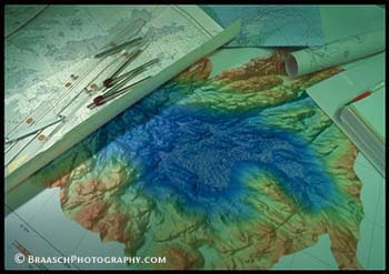
Geology. Maps. Navigation. Ships. Exploration. Antarctica. Multibeam sonar chart of Palmer Deep near Anvers Island, Antarctic Peninsula (NSF ship NB Palmer) |
|
To access this shot and others on this topic, please call Braasch Photography at (503) 860-1228 or email to gary@braaschphotography.com. More information about Braasch Photography is at http://www.braaschphotography.com